
Mining, forest and coast studies
Sixty years of land use, side by side.
Mines, forests and coastlines change slowly, then all at once. Film from the 1960s gives each of these places a starting point that modern satellites cannot. See also our city and settlement studies.
01 / Open-pit mining
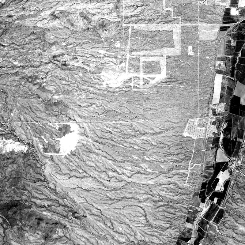
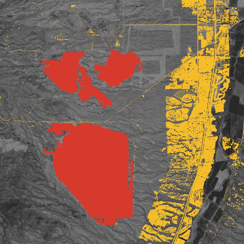
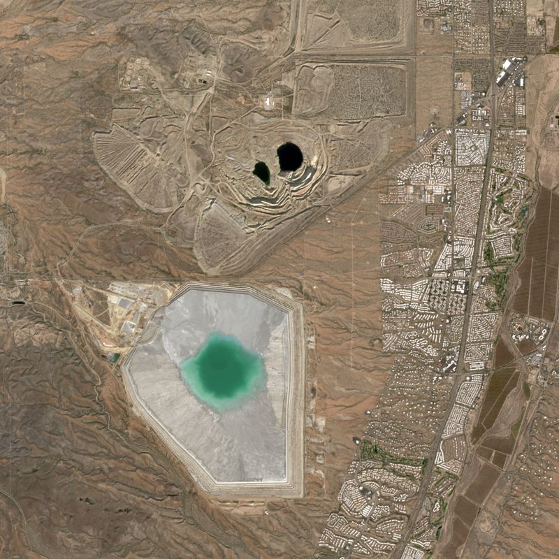
Arizona: copper mining in the Sonoran desert.
In October 1965 this view south of Tucson was mostly open desert, crossed by dry washes, with early clearings and one bright tailings area. Today it holds a deep pit, large waste dumps and a tailings pond, with housing along the valley to the east.
02 / Mine closure
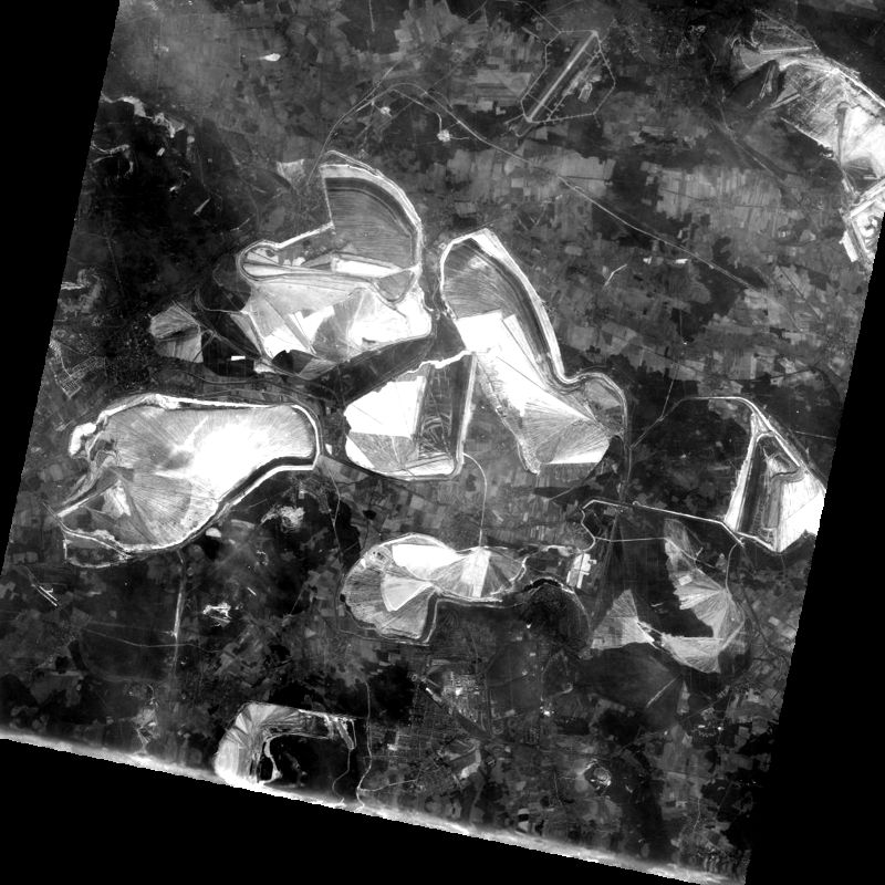
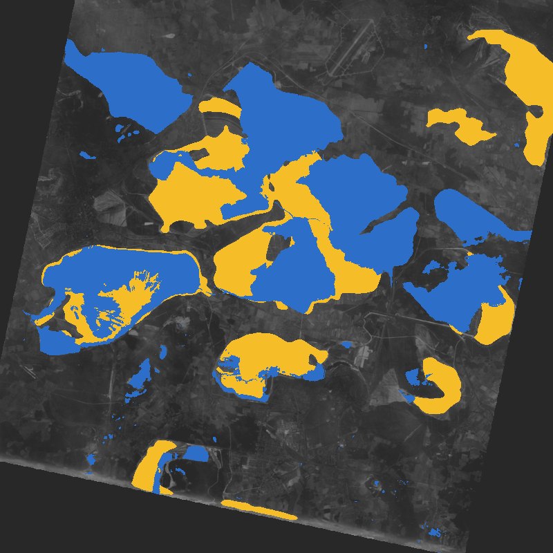
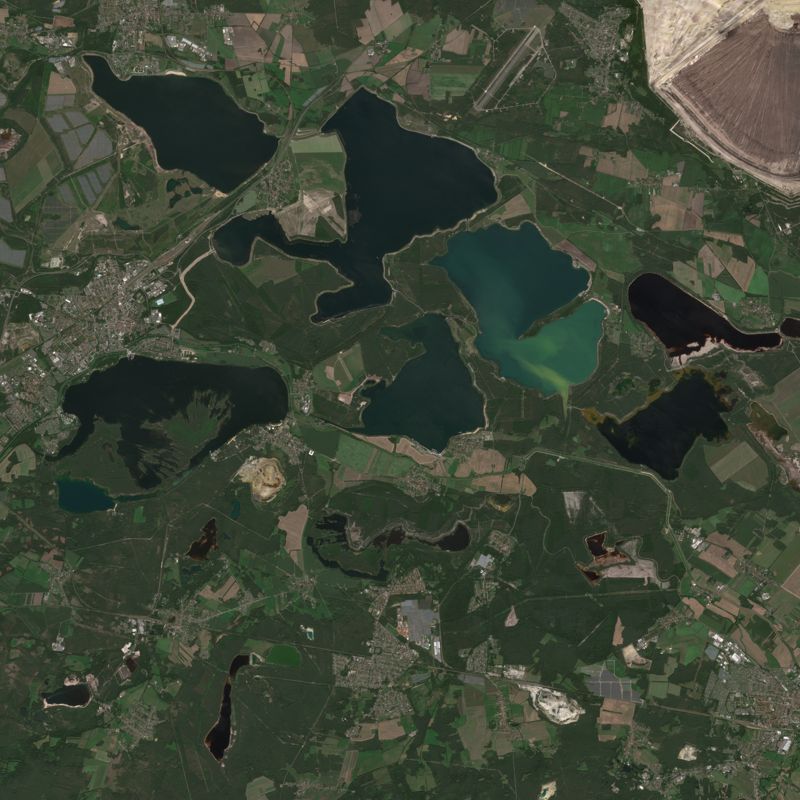
Lausitz: when coal pits become lakes.
East Germany's open-cast lignite mines were working at full scale in 1965. Most of the pits in this view have since been flooded and now form part of the Lusatian Lake District, while one large mine still works in the top-right corner.
03 / Industry and pollution
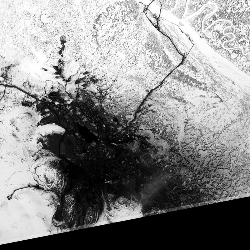
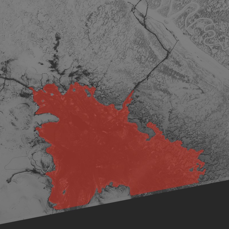
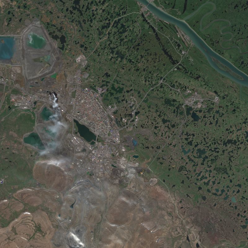
Norilsk: the dark stain on the Arctic snow.
On this May day in 1966 the land around Norilsk was still white, except for a dark area spreading out from the city and its mines. Smoke-like plumes are still visible in the 2026 image.
04 / Deforestation and regrowth
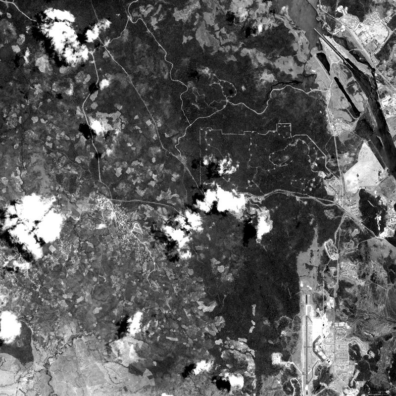
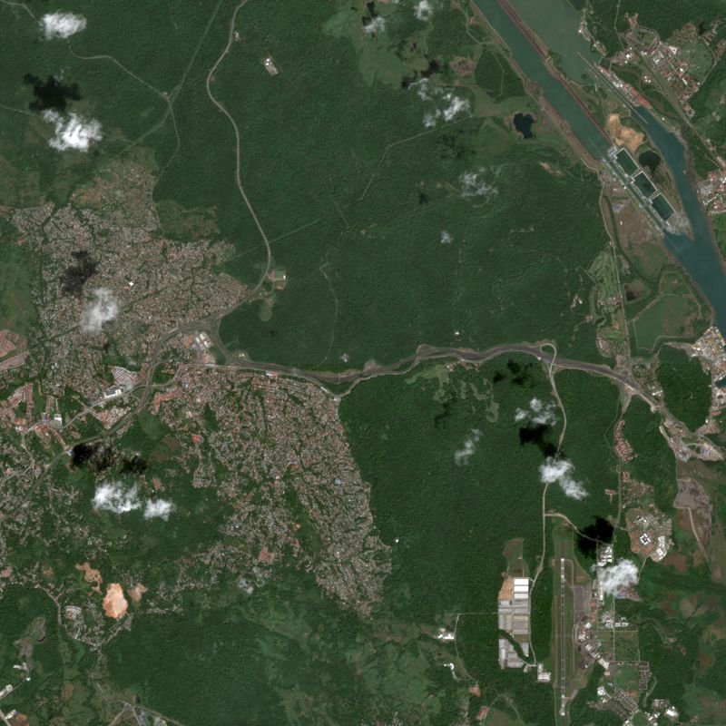
Panama: where the suburbs stopped.
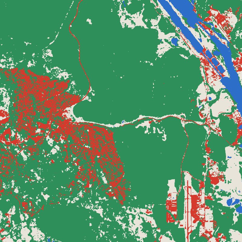
West of the canal, suburbs now fill land that the old film shows as forest and small clearings. They stop at a sharp edge. Beyond it, clearings that were visible in the 1960s have since closed into solid forest.
05 / Coasts and green land
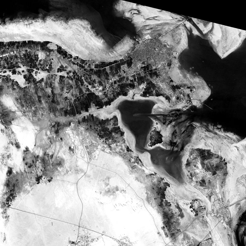
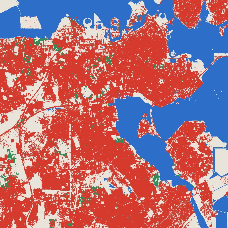
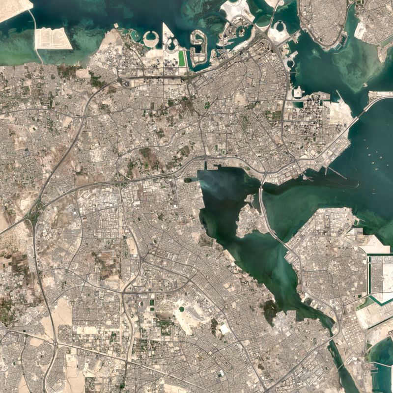
Bahrain: new coastline, vanished gardens.
In February 1967 a dark belt of gardens ran along the north of the island, with open desert to the south. Today that belt has largely given way to the city, and new land extends the shoreline into the sea.
How to read these numbers
- The maps are quick, automated readings and have not been checked in the field. A commissioned study would validate them first.
- Areas on the film come from simple brightness rules, so treat them as approximate. Modern areas come from ESA WorldCover 2021, while the modern pictures are newer.
- Mine land is WorldCover's bare ground in large solid patches. Dumps that have regrown, or small workings, can be missed.
- Panama's date is an estimate. Thin cloud and shadow appear on some images.
Sources
- Historical imagery: U.S. Geological Survey declassified archive.
- Modern land cover: © ESA WorldCover project 2021. Contains modified Copernicus Sentinel data (2021) processed by the ESA WorldCover consortium.
- Modern pictures: contains modified Copernicus Sentinel data 2025–2026.