Advanced Satellite Earth Observation & Change Detection Solutions
Transforming satellite data into actionable insights
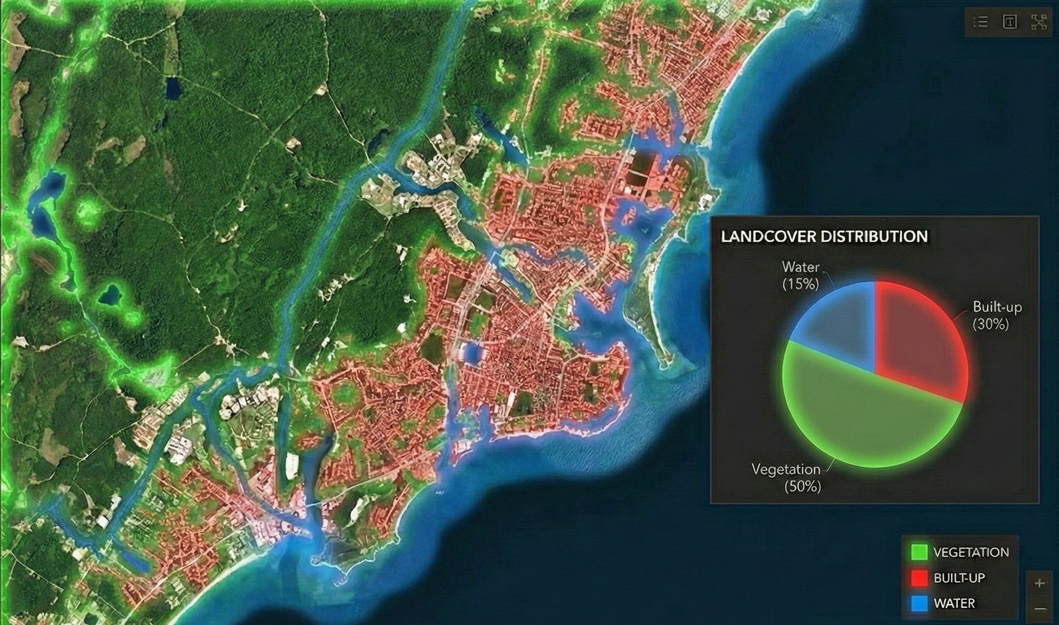
State-of-the-art machine learning algorithms to detect, analyze, and quantify changes in Earth's surface over time.
Decades of archived satellite data to understand long-term trends and patterns in environmental change.
At Earthlytix, we harness the power of multi-decadal satellite Earth observation to monitor and map changes across our planet. Using cutting-edge remote sensing technology and advanced data analytics, we transform complex satellite imagery into clear, actionable insights.
Our solutions enable organizations to track environmental changes, monitor urban development, assess deforestation, and evaluate infrastructure growth with unprecedented accuracy and detail.
Whether you need to monitor land use changes, assess environmental impact, or track large-scale developments, our Earth observation services provide the data-driven intelligence you need.
Specialized Earth observation services for diverse applications
Advanced algorithms to identify and quantify surface changes over time.
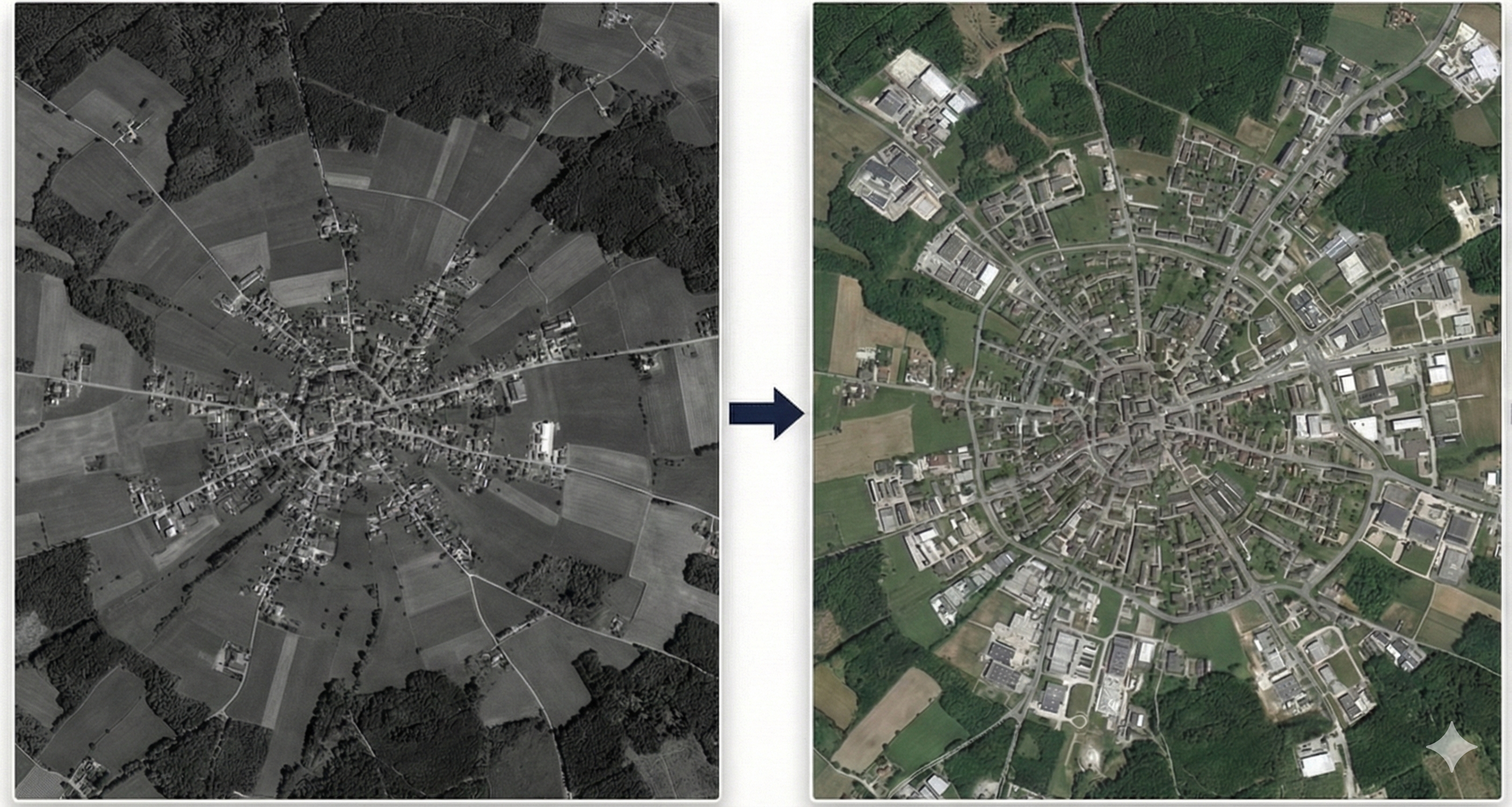
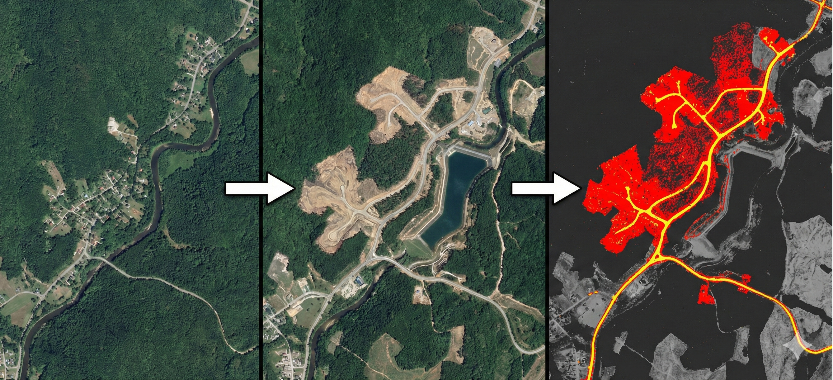
Track urban growth patterns, sprawl dynamics, and metropolitan development to support sustainable city planning.
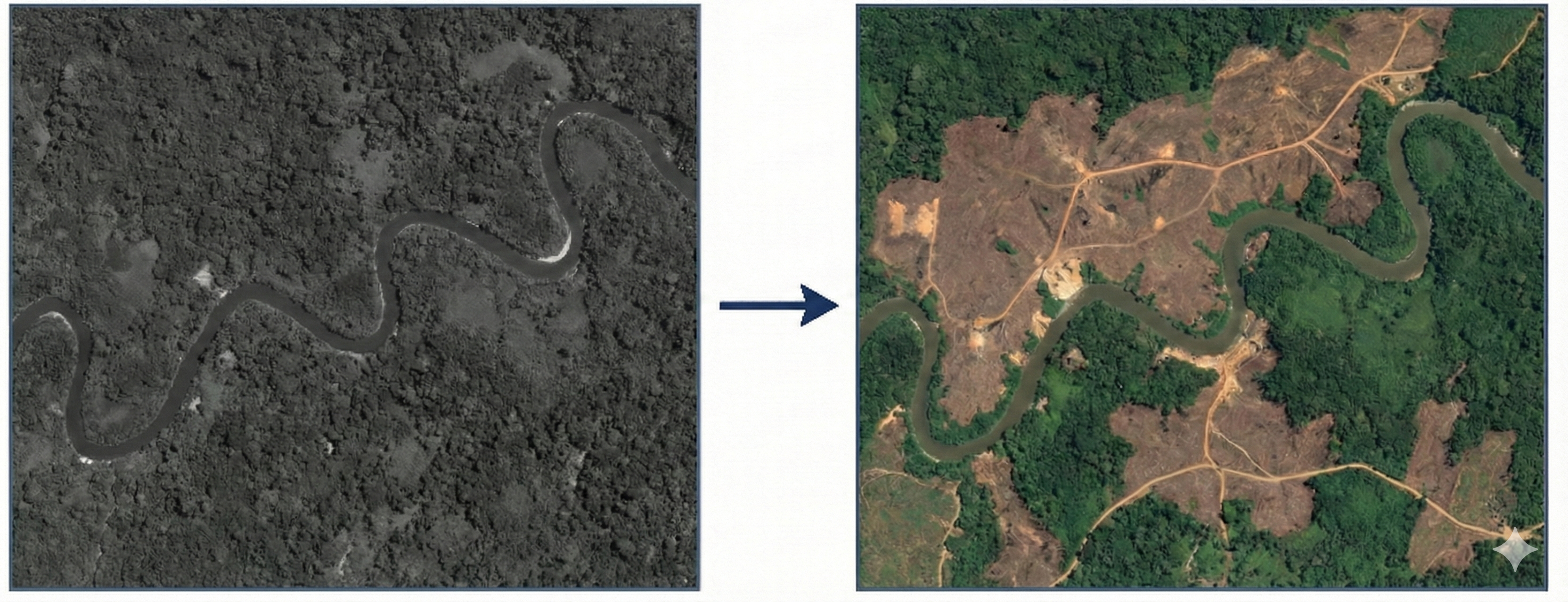
Monitor forest loss to support conservation and compliance efforts.
Let's discuss how our Earth observation solutions can help your project
Remote Sensing Lab
Geospatial Innovation Center
Global Satellite Monitoring